 Armitage Drive was built in the early 1950’s along with other streets in the area when the Town Council purchased the Shankston Bing site. Named after Dr William Armitage, a local doctor who served the local community from 1904 until he retired in 1947.
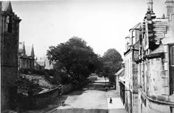 Ayr Road is one of the main roads through the town and means literally the road to Ayr (the county town). Ayr Road leads of Glaisnock Street and was opened in the late 18th century, and in the early period there was a toll on the corner of Ayr Road and Glaisnock Street. Tolls were levied on goods and passengers coming into Cumnock.
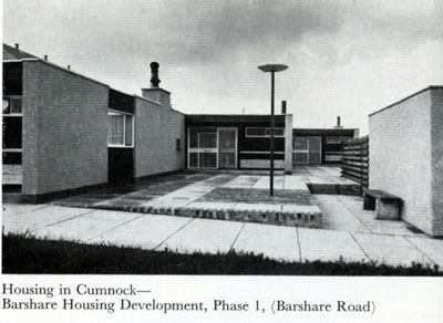 In 1957 the Town Council’s plans for a new housing scheme on the farmlands at Barshare was their most ambitious to date. They employed well-known architect Professor Robert Hogg Matthew to design and build a million pound scheme of 550 houses. The scheme and houses were cutting edge for the time with tiled under-floor heating, wide use of pine built-in storage, modern kitchens, open plan internal stairs with ultra modern rendering, street lighting and furniture.
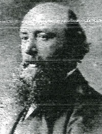
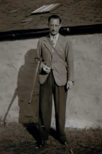
 Built in the early 1950’s and named after Emrys Hughes, Keir Hardie’s son-in-law who married Nan Hardie. Emrys was a journalist and editor of the Socialist journal Forward. Hughes stood in the 1946 South Ayrshire by-election and was elected as the constituency’s MP, and re-elected in the general elections of 1950, 1951, 1955, 1959, 1964, and 1966. A left-winger, he was frequently at odds with the leadership of the Labour Party and twice had the whip withdrawn, between November 1954 and April 1955 (over German rearmament), and between March 1961 and May 1963 (over nuclear weapons). He was Provost of Cumnock from 1934-1935 and a member of the Town Council from 1927-1947.
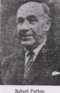 Built in the early 1950’s and named after Robert Forbes, Burgh Surveyor and Sanitary Inspector, who came from Buckie to Cumnock as a fully qualified applicant with a certificate in Sanitary Sciences. He served the town for 41 years, from 1915 until 1956. After he died in 1963, he could have been named the “Architect of Cumnock”, as he had planned and built hundreds of the town’s houses.
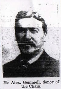 Built in 1924 and named after Alexander Gemmell who was a local benefactor at the beginning of the 20th century. He was a native of Cumnock where he worked in the Royal Bank. He moved eventually to Bradford and to Barclay’s Bank where he held an important position. In 1916 he noted the 50th anniversary of the burgh by presenting a Provost’s Chain currently on view in the Baird Institute.
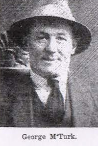 Built in the late 1960’s adjacent to the New Cumnock Cemetery in Glaisnock Street. Named after George McTurk, who began his public service in 1894 as a member of a miner’s committee during a strike. Thereafter he served on local public authorities for 43 years. He joined Cumnock District Council in 1923 and was chairman for 9 years. For over 33 years he was on the County Council and was acclaimed for his long service and efforts at his retiral presentation in Cumnock Town Hall on 1st June 1951. George McTurk was awarded the OBE in the Coronation Honours List published in July 1953.
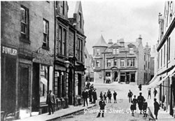 Opened in the late 18th century and named after the Glaisnock Water. The Gorbals bridge was built here in 1775. This is the other main street in the town and in days gone bye used to contain many of the town shops and bars.
Experience Cumnock History
Cumnock History Group are a constituted Voluntary Group who share an interest in the history and heritage of Cumnock and how the past has influenced the present.
The group emerged as a result of the Memory Bank workshops for Raising the Bar – the archaeological dig focused on the site of the old Tup Inn on Lugar Street earlier this year and run by archaeologists from Northlight Heritage
Support CHG
Participate
Publications
All photos Cumnock History Group or by permission of East Ayrshire Council / East Ayrshire Leisure unless otherwise stated.